

Day 21: Mile 369.3 to mile 389.1 (19.8 mile, 31.8 kms, 10 hours).
It’s always difficult to get back on trail after a day off. Getting out of a comfy bed, putting on your laundered but still smelly hiking clothes and walking away from on tap fresh water (hot and cold) is hard to do.
One last look around to see that I have everything I pulled the door locked and hit the road. No going back now.
Wrightwood is a great location to hitch back to the trail from but there wasn’t a lot of early traffic when I hit the main road. I was there with my sign out “PCT Hiker to Trail” but most the traffic that past was going local and turned onto side roads after passing me. I tried for around 2O minutes with not much success. I was rather annoyed when a young 20 something blonde female in short shorts and long legs arrived on scene, stuck her thumb out and instantly got a ride. WTF. Oh to be young and pretty.
Not to worry about 5 minutes later a driver pulled over who was taking another hiker to the trail head and gave me a ride too. Turns out the driver is the manager of the Acton KOA campsite which I’ll hit on a few days time.
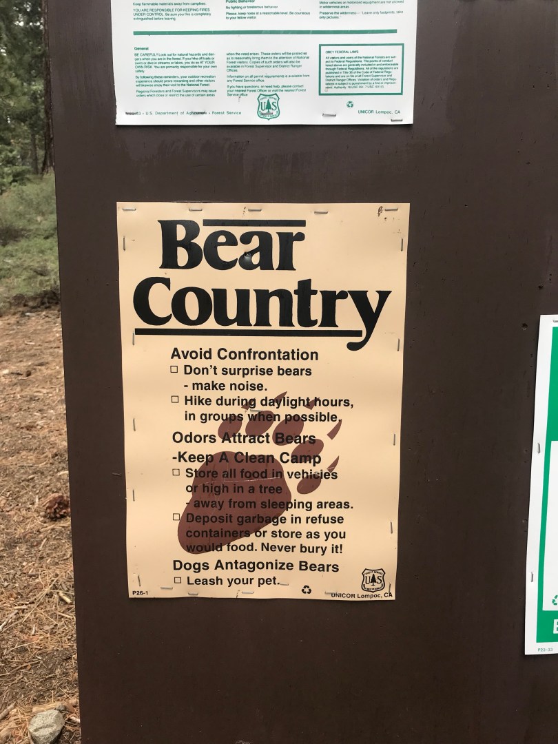
I found my trail legs early. After a good rest in town they were ready to get going although my shoulders were complaining with a heavy food resupply. I’ve also added a bit of weight to my pack by swapping out my Cuban fibre food day for a heavier duty Kevlar bear bag as I move into bear country.
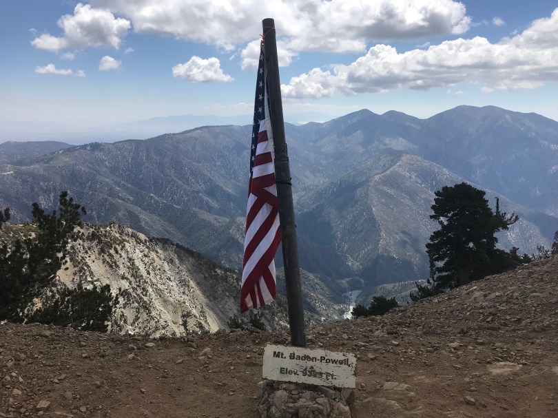
The first 5 miles or so were easy enough then it was up, up and away for 4 torturous miles to the top of Mt Baden Powell, named after the man himself. Conditions were challenging as the steep ascent had me sweating profusely but there was a cool wind that would chill me to the bone on stopping so it was a case of keep going to the top.
Views were spectacular from the the although a little overcast. The Mojave desert stretched out to the horizon to the north, the flat expanse filling my field of vision. It is this that has to be tackled over the coming weeks.
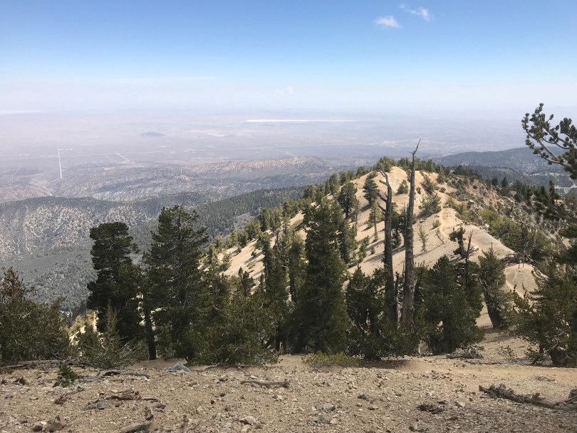
From Baden Powell it was mostly down for the next 10 miles with some sections actually following ridgelines. Great views back to the south overlooking forested mountains rising out of a sea of low lying fog.
It from mile 386 at Islip Saddle that things got interesting. The first pointless up and down section I’ve come across. At the Saddle the trail crosses Hwy 2 to climb straight up for a mile and half to Mt Williamson, only to descend straight back down to the same Hwy. 4 miles of silliness.
I was aiming to do around 26 miles today but after Mt Williamson my body said no, 20 miles would be enough.
So I’m camped on an abandoned road 0.1 Mile back from the Hwy and picnic ground. Given I’m in bear country I’ve heard that they can be attracted to picnic areas and the like given the presence of rubbish bins (even though they are near proof bins). I’m on my own tonight and taking every precaution including cooking dinner away from camp and securing my food.
There is an endangered frog species trail closure to get around first thing in the morning as it starts from the picnic area. This will have to be a bit of road walk and the take an alternate trail back to the PCT where it is open again.

Wow. Well done. Some of those rock formations remind me of the Flinders Ranges. Ancient, waves, weathered. I bet it was great finding that cool water. Here in Aus my young sister Kim had her 50th birthday and her son Aaron turn 18. It was a lovely celebration on Saturday. Lots of family together with karaoke and people giving it a try out. Lots of love from me