

Today commenced with an early visit to the bakery, just as they opened to grab a breaky roll, fresh coffee and ham and salad sandwich for lunch. A fresh roll, meant one less peanut butter wrap to consume which I’m getting pretty tired of.
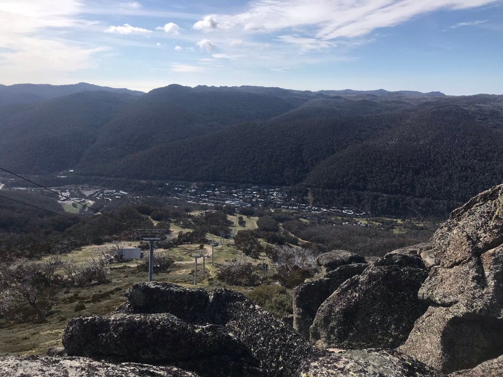
From breakfast it was straight into a hard and gruelling uphill climb along the Merritt’s Nature Trail to relink back with the AAWT. I was looking forward to skipping the climb but unfortunately the chairlift up the hill from the base of the valley to the Eagles Nest was out of action, so that left only one way to get up the hill – on foot. The climb is about 4 kilometres rising from 1380m to 1960m. Needless to say it made for hard and sweaty work so early in the morning. The consolation was that the track was at least switched backed for quite a ways making for much easier work rather than a push straight up hill. It took about an hour and a half up, slowing my typical pace by a third.
From the Eagles Nest above the tree line the views were spectacular and it was easy going all the way towards Mount Kosciusko, the terrain flattening out along on open plateau into more undulating terrain. Straight from the Eagles Nest, the popular Kosi walk to has been constructed on metal walkways elevated off the ground to corral the thousands of visitors into one place and maintain a sustainable track. There were very few people out this morning and heading towards Kosi it felt like I had the place to myself. Every other time I’d been here the place was swarming with people.
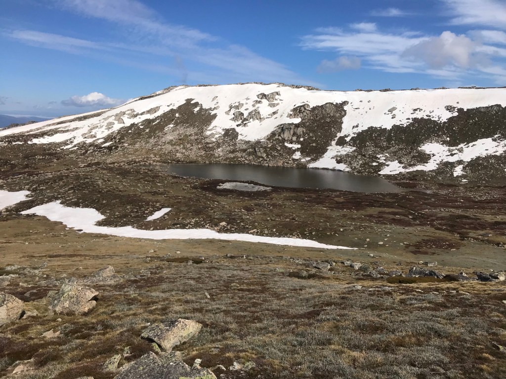
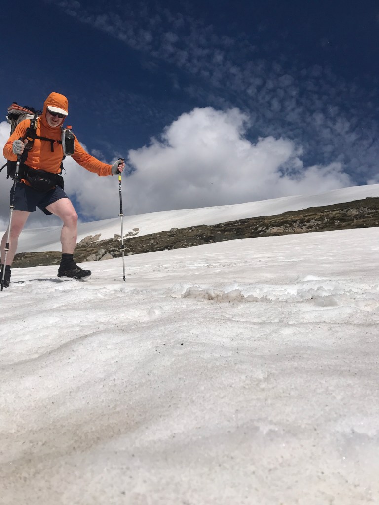
Plenty of snow still blanketed protected faces of the higher ranges and several drifts covered portions of the main track. These had softened in the sun already relieving concerns that they might still be icy from the overnight freeze. It was a magical day. Full sun with a light breeze. Perfect walking conditions.

Approaching towards the Mount Kosciusko turnoff I passed two ladies headed southbound and we filled each other in on the track conditions we’d respectively encounter over the coming days. They reported really icy conditions across Curruthers Peak.
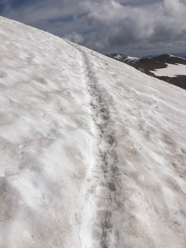
Soon enough I wound my way on the contouring track around the back and onto the top of Mount Kosi, traversing a broad and deep section of snow that still covered the track on the southern side. Multiple steps had previously been kicked in and this made for easier work although still slippery in a few spots. Grateful to have my trusty walking poles to assist maintaining balance and sliding downhill.
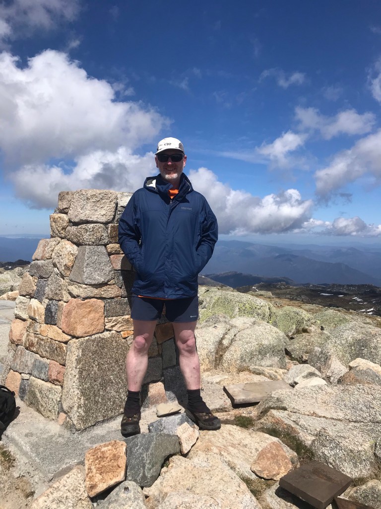
Reaching the top of Kosi, I had the place to myself. On top of Australia in perfect weather, I spent 10 minutes just sitting still and contemplating the world. After a little snack and water it was time to keep going. On towards Curruthers Peak.
Towards Curruthers I was amazed at the level of maintenance work that had been put into the track. While it does form part of the AAWT I’m sure this work is intended more for the thousands of summer visitors than AAWT hikers. The track had some pretty awesome rock works completed to harden the track surface and keep it in a sustainable state. It was great to see investment in our parks in this way.


Then for a couple of kilometres before Curruthers Peak it was back onto the metal grid platforms. I didn’t mind these sections as it made for fast walking but it almost meant my legs doing all the work, unable to use my trekking poles as they would catch in the metal grids.
At 11am I stopped for a break and checked my maps, realising with surprise I still had 25km to go for the day towards the Guthega Power Station. Achievable for sure although I wasn’t quite sure I’d make it all the way and was prepared to just keep going until I’d had enough, finding a spot to camp on the side of the trail. I had to keep moving.
Approaching Curruthers Peak I could see that the all the southern faces still held snow and it looked like there were numerous snowboard track lines cut into the white stuff. The faces off the peak were solid steep and inviting in the soft spring snows.
On reaching the top of the peak I tucked into that ham and salad roll from bakery. Delicious and so much better than the standard fare I’d been consuming so far. Looking across to the east I saw a couple of young punks who had hiked in with snowboards assessing lines down the southern face, confirming my suspicions that all the chutes off the southern faces did in fact have recent track marks. This brought back fond memories of climbing Mt Bogong in Victoria to do just the same thing.
From Curruthers I had intentions of heading out across the main range following a route called the Rollings Grounds and believed the navigation app I was using would lead me this way. Unfortunately as it turned out the route on my app led my along the official AAWT route and away from the Rolling Grounds. I should have paid more attention to where I was headed and have been prepared with paper maps rather than blindly rely on an app. Oh well. That just means I’ll have to come back in the future and complete the Rolling Grounds route.
Off the back of Curruthers Peaks, there were multiple long sections of snow to contend with. All soft underfoot in the midday sun now and with clear lines to take from previous passers by. The tell tales signs of former icy sections now melted would have been the sections the south bounders told me about. No issues for me at this time of day. It would have been interesting for them in the morning. If you slipped on the ice in the morning and couldn’t self arrest you’d have a long ways to travel downhill at a rapid pace.
With all the snowy sections out the way it was vehicle track downhill to a track junction that would lead me to Geehi. At the bottom of the valley I had to cross the upper reaches of the Snowy River which was about 20m wide. Thankfully carefully placed rocks created a dry foot crossing the whole way across.

On reaching the track junction leading off towards Geehi at 2pm and seeing the standard of track I was confident I could make the remaining 16km to the Guthega Power Station before nightfall. It would just take some persistence and stamina to keep going. Averaging about 4km/hr with some breaks in between I figured I should reach my destination by around 18:30. Sufficient time to setup camp before dark.


It was an 8km stretch to Geehi following the Snowy River and it was awesome. The entire length had been hardened in some form, from gravel base to metal platforms to intricate stone work. 8km of hardened track! Again I was amazed at the investment that this area of park receives.
From Geehi it was another 7 or 8km road bash to the power station. By this stage my feet were tired and shoulders sore, a heavy laden pack digging deep into my shoulders. It was necessary to take a short break every hour just to get off my feet and relieve the pressure off my shoulders.
Relieved, I’d made it all the way by 18:15. A huge day, I had no idea of the total distanced covered just yet but was super stoked with the confidence I gave myself to get here. There had obviously been a heavy shower of rain that I’d missed on the way over, the road and ground showing the aftermath with puddles of water about.
I ended up setting up camp on the edge of the power station visitors carpark. There is a toilet, picnic table and plenty of water. What more can you ask for?

