

Fog hung low deep along the Mitta Mitta River corridor this morning. The sun not quite over the horizon had lit the nearby hills. My tent was still shaded. It would be a massive day ahead. Food drop collection day and some big climbs. Time to get moving.
The original track route along the river was closed due to English Broom control works and my app pointed me in out along country roads, past farmlands. Paddocks lush green with recent rains and cattle looking healthy. It didn’t take long to hit areas the sun had found and take a few layers off. Once out in the sunny it is instantly warmer.
Todays start was easy weaving along backcountry roads. Not a single sole about. Only cattle to keep me company, charging up the fence lines ahead of me.
I soon found myself on a lovely piece of single track, gradually climbing a spur line to a small knoll overlooking the valleys below. But like much of the AAWT what starts out great soon turns to complete carnage. The track lead down towards Morass Creek and quickly became an unkept mess. Another steep decline, this section has the bonus of being on a side slope with no bench at all causing ankles to bend at an unnatural angle. Sections looked like they had been benched out at some point to create a flat surface. This didn’t last long, perhaps the effort for the low volume of traffic just wasn’t worth it. Perfect Sambar country. I spooked a few, hearing them crashing off into the undergrowth. I was led onto a rocky bench overlooking open grassy areas and the morass below. English Broom was everywhere.
Reaching the morass it was obvious there would be no dry crossing this time around. A wide marshy bog lay ahead thick with reeds and multiple branches of the same water body splitting and converging again. The main channel was too wide to jump and there were no logs or rocks forming dry platforms to cross. Balancing precariously on a bed of reeds surrounded by water on all sides and balancing my pack I managed to reach down to each shoe and remove them with my socks, dangling them around my neck for a bare foot crossing. The water was murky with no telling how deep it was. Placing one foot into the water it found it was knee deep with a gravel bottom. This made for an easy crossing.

Feet dried and shoes back on once on the opposite side it was a short climb back up through an area of open forest, towards my food drop. I couldn’t believe the grass growth in this area over just a few short weeks since placing my food drop here but the area did see 200mm of rain around the same time.
I recovered my food drop and dropped my pack to go in search of the other food drop where my team has placed my hat. This happened to be on the opposite side of the road and nowhere near my drop but easy enough to find based on the screen shot photo I’d been sent of its location. Recovered, Operation Hat Drop was a complete success.
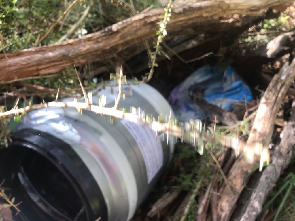
I quickly sorted through what I had in my drop and what I would really need for the section ahead, pairing down to the absolute minimum to reduce the weight that would have to be carried. Leaving my rubbish behind, swapping out hats, dropping old maps, even leaving a can of beer behind, making sure to carry at least one out with me for tonight. I’d be back to collect the barrel in about a months time. I had my food sorted to see them through to Theedbo and was off.
Crossing the Benambra-Corryong Road I am well and truely back on home turf, walking through one of the planned burns I would deliver later in Autumn. A huge burn of 12,000ha broken into smaller 4,000ha blocks to be conducted over several years. It is expected that burn officers understand the bush they are responsible for fuel reducing and there is no better way than walking right through it. I’d studied this area in detail, pouring over maps and seeing the different vegetation classes and other features on a computer screen but it is very rare to walk through a block of this size and see things in reality. A fantastic opportunity indeed.
The walk up slope started really well. Open forest structure and relatively clear, I was confident this would continue, placing my trust in the track sufficiently to pair down to shorts and expose the lower legs. How wrong could I have been. Of course things were going to deteriorate and the awesome track conditions didn’t last, quickly turning into absolute garbage again. Arrhhhh. So frustrating. I have a real love-hate relationship with track. There was a nice scrambing section through a rocky outcrop I’d seen on aerial photos during my burn planning. This was a lot of fun.


Beyond that I was soon pushing hard straight uphill again, on a barely visible foot pad, loosing the ‘track’ multiple times and scratching past encroaching vegetation, cutting my legs up. This was another climb I’d underestimated, slowing my ascent to a crawl. Again I wouldn’t quite make it to the top before having to call it quits for lunch, rehydrate and gain some energy back. A full and heavy resupplied pack didn’t help much either.
Damn I couldn’t wait to get to the top of this spur and out onto forest roads. I usually hate road walking but have come to prefer it over these shitty sections of non-existent track along the AAWT. And I keep coming back to thinking what a world class trail we could have with some effort from land managers to reroute and switch back a few of these section.
Stumbling out to the road I had had it. The section up ahead beyond Jonnies Top was going to be much the same and notoriously overgrown after the 2019-20 bushfires. I vowed right then and there that I was done with bush bashing for the day and that I would take an alternate route on forest roads to Buenba Flat. I’d been to Jonnies Top multiple times for work and had seen the bush for myself. I had cut up my legs enough today to swear off the bush bash down from Jonnies.
My mind firmly made up I turned right at the next AAWT track junction, wondering onto my own route. Of course this route was much longer, about 8km linger. I didn’t care and didn’t want to think about anything else other than reaching the Buenba Road.
I was off and racing. Up, down, undulating forest roads onto Deep Creek, Beloka Road and out onto Buenba Road. Along the way, mind focused else where I came across one of the largest Tiger snakes I’d ever seen. Sprawled out straight across a road I mistook it for a branch at first, it’s body almost as long as the road was wide. Within 2 metres, it obviously felt the vibrations of my heavy footsteps and walking poles on the ground and started to move. Only then did I realise it was a snake and froze in my tracks. It wasn’t a happy camper. Moving to the side of track it stopped leaving sufficient room for me to move past safety. As I did so it splayed its head, puffing out aggressively. Slipping past, it turned, raised its head and hissed loudly at me, keeping its eyes locked onto me. Phew. Scary stuff. Wait till you see the video footage.
Pushing hard up Buenba Road, its relatively flat and easy going but a long way to the Flat. I stop for a short break at 16:00 and realise I still have 16 km to go. Even at a good pace of 4km/hr late in the day its going to take me past dark to reach Buenba Flat. I settle in for a long, painful road bash, punching out as hard as I could without doing damage to my legs. The repetitive walking action on roads can easily lead to overuse injuries and I can feel my legs getting tight.
I make it a good chunk and start preparing my mind to be walking into the dark and to be setting up camp well into the black. It’s close to 6pm and I hear a car approaching from behind on this lonely road. On a Saturday evening in the middle of no where, on a road leading to no where in particular what are the odds of a car? I chance it and stick my thumb out with still more than 10km off reaching Buenba Flat.
Sort of obligated to in the middle of nowhere the car stops, the window comes down and they ask me where I’m headed, surprised to see a hiker out here.
Me: “Buenba Flat. I’m hiking the Alps Walking Track but have taken an alternative to save a massive bush bash off Jonnies Top but its beaten me and way longer than I though”.
Them: “We’re headed there to go fishing. Let me pull over and rearrange some stuff for you.”
How bloody awesome is that!
It’s Shannon and Ash Pendergast, local cattle farmers from Benambra with the kids headed out for a fish. Shannon quickly rearranges some gear and has another seat setup in the very back of the 4WD that one of the kids jumps into and Ash jumps in the back with the others, telling me to jump in the front. I tell them I stink real bad and won’t be offended if they need to open the window. “No worse than fishing gear.” Shannon says. “Jump in.”
How bloody lucky I was. It turns out we know quite a few of the same people and conservation was easy all the way to Buenba Flat, me looking at the kilometres click over out the window and thinking ‘what was I thinkibg with this alternate route?’. They drop me off and head off fishing. I find a quiet spot sheltered by trees and am able to set up camp and get dinner cooked before the sun comes down. Counting my lucky stars, I have no qualms at skipping a short section of the AAWT that I’ve been to before and knowing what the bush bash looked like just a few weeks ago.

