

PCT mile 1679.3 to mile 1695.0 (15.7 miles)
Hendrix Fire Reroute to mile 1708.2 (20 miles)
Total: 35.7 miles, 57.4 km!
It had to be an early start today as I had a massive day ahead to get around the fire closure. The payoff was that the border is only a few hours away and I’m very excited to finally be done with California and moving north into Oregon. Plus I suspect the road walking will be at a quicker pace than on trail so I’ll gain some time and distance there.
The section on the PCT itself was straight forward and I got away to a flying start. A few minor ascents but otherwise flattish. After a few hours I found a shady spot to smash down some breakfast, a few pastries carried out of town instead of the usual pop tarts. Sweet Tooth and her partner walk by and I continue on. An uneventful few hours follow.

Reaching the final known decent water source before the fire closure I stop for a break and fill up with as much water as possible, walking away carrying 5 litres. No one really knows what the fire closure water situation is like so best to be on the cautious side.
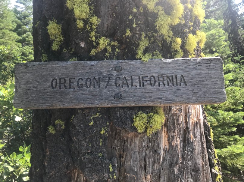
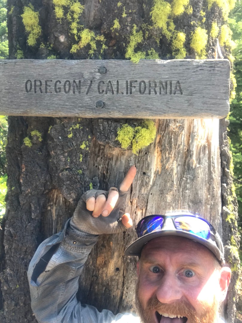
Only another mile and a bit I finally make it to the border. I first dreamt of walking the PCT around 10 years ago, watched a million videos of hikers reaching this point and have waited that long to finally reach this iconic tree marking the California-Oregon border myself. It feels so good to reach such a milestone and be finished with California. I stride into Oregon with a renewed sense of pride and high spirits.
I walk for another three an a bit miles on a high to the fire closure. There is a simple note held down by a rock sitting on top of one of the trail marker poles. There is no physical barrier across the trail. The note reaffirms that the road walk is dubious and the PCTA advises hikers to backtrack. Backtrack? Hell no. I’m not backtracking anything.
The roads are indeed a maze. Many intersecting and unmarked logging roads. I have the route planned out on one of my mapping apps and find it fairly straight forward to be honest. Many of the mapped roads don’t actually exist anymore, long overgrown and I only find a few direction changes questionable.
The pace is fast on the roads and I find plenty of water along the route. Water is flowing in many of the drains and roads cross multiple culverts with running water but I have plenty having hauled up water from California.
I prepare myself to be walking into the dark by digging out my head torch over dinner, another no cook tortilla preparation, packet tuna replaced by packet spam. The pace continues to be quick and I surprise myself at the distance covered. I realise I can make the reroute before the sun sets at around 9pm.
There is one super hard section of the reroute where it follows mapped logging roads that have long been reclaimed by nature. Thickly overgrown with vegetation. Several sections on a steep climb requiring a physically exhausting push through vegetation for 50 ft sections. The footprint of the road can be seen but there is no obvious path through the veg given I’m one of the few people to try this section.
Finally I reach the last connecting road. Just over 1.5 mile to my goal I crank up some Eastern Beach on my phone and step into gear.
Just before 9pm I arrive at Grouse Gap shelter to find Camel awake in his tent. “How did you like the scrub bash?” he asks. I show him my scratched and bleeding legs in response, grinning from ear to ear. “That’s 36 miles for me today!” I gloat.

what an achievement